> New : The GR de pays© (long-distance hiking route) 'Tour du Vercors Drôme' (Tour of Vercors Drôme)
This hike is in the shape of a figure of eight, with la Chapelle en Vercors as the center. The first loop runs through the southern cornice of the Vercors reaching Font d'Urle. The second loop overlooks the great gorges of the Bourne and the Grands goulets. Together they make up a week-long route.
This route can by found on the map : carto guide Vercors-Drôme published by Vercors Park
> Long-Distance Hikes on the Vercors High Plateaus
GR91 and GR93 as well as GTV routes allow you to cross the Natural reservation from east to west and from north to south, a paradise for hikers.
Please note that access to water is infrequent, especially in mid-summer when the springs can dry up. Unmanned shelters (without water or electricity) are available (bunks, wooden stoves...)
Carry with you a compass and/or GPS and appropriate equipment, as well as sufficient water to hike in the wilderness.
Bivouacking is allowed between 5pm and 9am
Create your own route with IGN Top 25, 1/25,000 MAPS.
Unmanned shelters and springs are indicated :
Top 25 IGN Maps that cover the Vercors High Plateaus Natural Reserve:
« Villard de Lans – Mont Aiguille » - TOP 25-3236 OT (North side)
« Glandasse – Col de la Croix Haute » - TOP 25-3237 0T (South side)
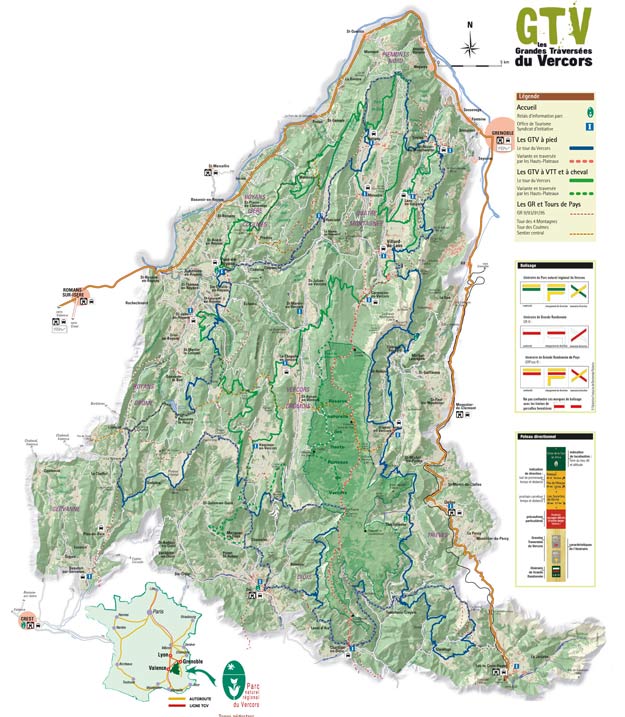
> Les "GRANDES TRAVERSEES DU VERCORS" (Vercors crossing)
Whether it's for a weekend or a longer stay, independently or with a guide, you will find routes that suit you on the GTV website: www.vercors-gtv.com
You will also find information about unmanned shelters and springs, to help you prepare for your hikes.
> FRAGILE NATURAL AREAS: Font d'Urle and Ambel plateaus
An Espace Naturel Sensible (Fragile Natural Area) is a remarkable site with public interest and heritage, recognised for its landscapes, ecology or geology.
Hikes are unforgettable on these vast spaces with magnificent panoramas, you will find routes on the Royans-Drôme Carto-guide.
Both Plateaus of Font d'urle and Ambel are crossed by GR93 and GTV routes.
Note the rules regarding dogs and bivouacking
Ecoguards', sworn officers from the département, are present on the site to provide information and ensure eveyrone respects the exceptional natural heritage.
More information : www.ladrome.fr/nos-actions/environnement/les-espaces-naturels-sensibles
Carto-Guide Vercors-Drôme
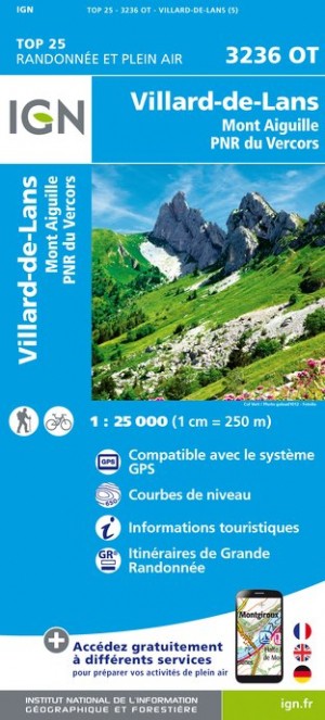
Carte IGN Top 25
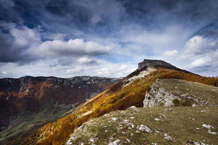
Plateau d'Ambel ©Matt Booth